 By admin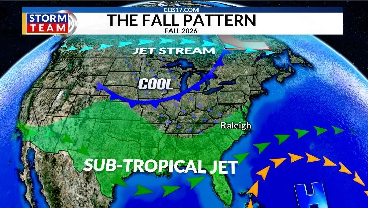
RALEIGH, N.C. (WNCN) — The summer pattern is finally starting to let go across central North Carolina.
Read more Hot Friday ahead of a rainy weekend in central NC
For much of the warm season, a strong ridge of high pressure dominated the central and eastern U.S., keeping the storm track well to the north. That led to persistent heat and a prolonged stretch of dry weather across the Southeast.

Raleigh reached 103° twice this summer, while the average high was around 91°. That made it the fourth-warmest summer on record, behind only three hotter summers, including 2025.

Rainfall has also been a major issue. Over the past 12 months, Raleigh has received roughly 16 inches less rain than average. The unusually wet July helped keep the summer from ranking among the driest on record.

A Pattern Change
As we move into October, there are growing signs that the stubborn summer pattern is breaking down. The ridge is shifting south and east, allowing a more active subtropical jet stream to develop across the southern U.S. This will help bring more moisture into the Southeast while allowing cold fronts and upper-level disturbances to push farther south.

For central North Carolina, that means a better chance for widespread rain and periodic shots of cooler air this fall. There is also some support from past strong El Niño events. All three of the strongest El Niños produced above-average fall rainfall across the region. Raleigh typically averages about 11.84 inches of rain during the three-month fall season.

That doesn’t mean every week will be wet or that the heat is completely gone. But after months of persistent heat and dryness, the larger-scale pattern is finally changing — and the potential for a wetter fall is increasing.
Read more No drought improvement across central North Carolina after dry week