 By admin
NOW PLAYING
RALEIGH, N.C. (WNCN) — With warm and humid weather associated with the remnants of Isaias moving through North Carolina, the National Weather Service issued a tornado watch for all of central North Carolina Sunday until 5 p.m.
The CBS 17 Storm Team already declared Sunday a Weather Alert Day with a severe weather risk from a warm front from Isaias.
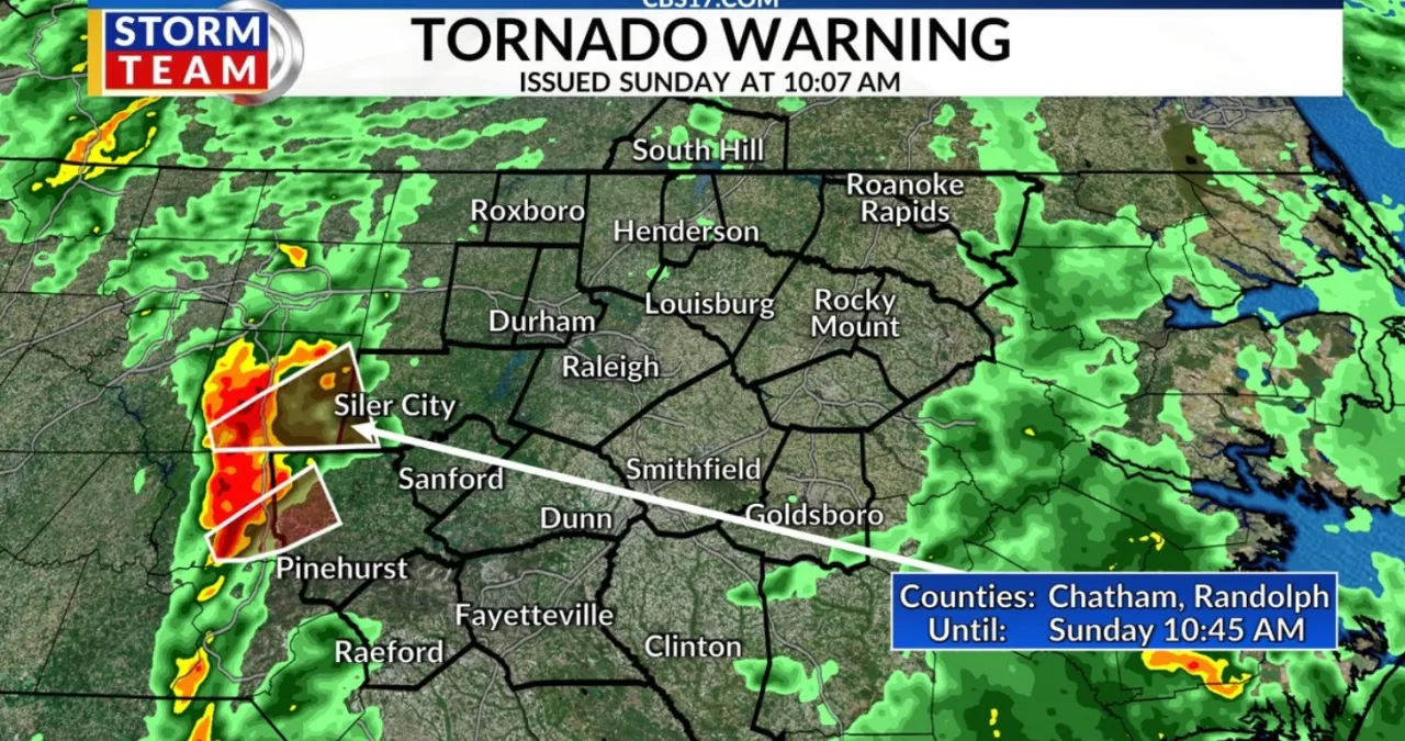
Just as the watch was issued, a tornado warning was issued until 10:45 a.m. for southwestern Chatham County.
The warning for Chatham County came as forecasters detected a severe thunderstorm located near Seagrove, or 7 miles southwest of North Carolina Zoo, moving northeast at 35 mph.
Read more NC trooper injured after I-85 driver plows into stopped cruiser in Orange County at I-40

Another tornado warning was issued for western Moore County around the same time until 11 a.m. as severe thunderstorms along a line from near Asheboro to 11 miles north of Rockingham, were moving east at 30 mph.

Just before 10 a.m., the National Weather Service issued the tornado watch for all of the central North Carolina counties — along with several to the east and west in the state.
Scroll below for the latest updates on weather warnings and watches in central North Carolina:
Read more Journalist Steven Petrow opens up about his sister’s choice to use medical aid in dying