 By admin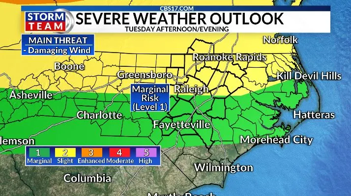
Tuesday will see low coverage of showers and storms. It will be very humid with highs back to the mid-90s. Even with few storms covering the area today, the isolated storms that fire could be strong to severe. Storm threat is again for damaging winds, heavy rain, and frequent lightning.
Read more Ski enthusiasts flock to sub-Saharan Africa and a snowy mountain resort in Lesotho
Wednesday will demand more attention to the weather. A slow-moving cold front will move across the area mid to late afternoon. This should bring a line of heavy showers and storms that could be strong to severe.
Heavy rain moving over areas that have seen rounds of rain in the days prior will be more prone to flash flooding. Storms will be capable of producing very heavy rain, frequent lightning, and strong, damaging winds. It could take from Wednesday afternoon to midday Thursday for the front to clear the area.
The good news is that behind that front, we will see cooler air for a few days. Highs will be in the 80s, and overnight lows will fall into the mid 60s for a few days. A nice break from the heat.
Read more Man stabs tourists near the Acropolis in Athens, Greece


FORECAST
TUESDAY will be partly cloudy with isolated gusty showers and storms. The high will be 94. Winds will be out of the southwest at 10 to 15 miles per hour.
OVERNIGHT will be mostly cloudy with lingering showers and storms. The low will be 74. Winds will be out of the south at 5 to 10 miles per hour.
WEDNESDAY will be mostly cloudy with scattered, gusty storms. The high will be 89. Winds will be out of the southwest at 10 to 15 miles per hour.
Read more Lebanon’s president will meet with Trump in Washington to push for Israeli troop withdrawal