 By admin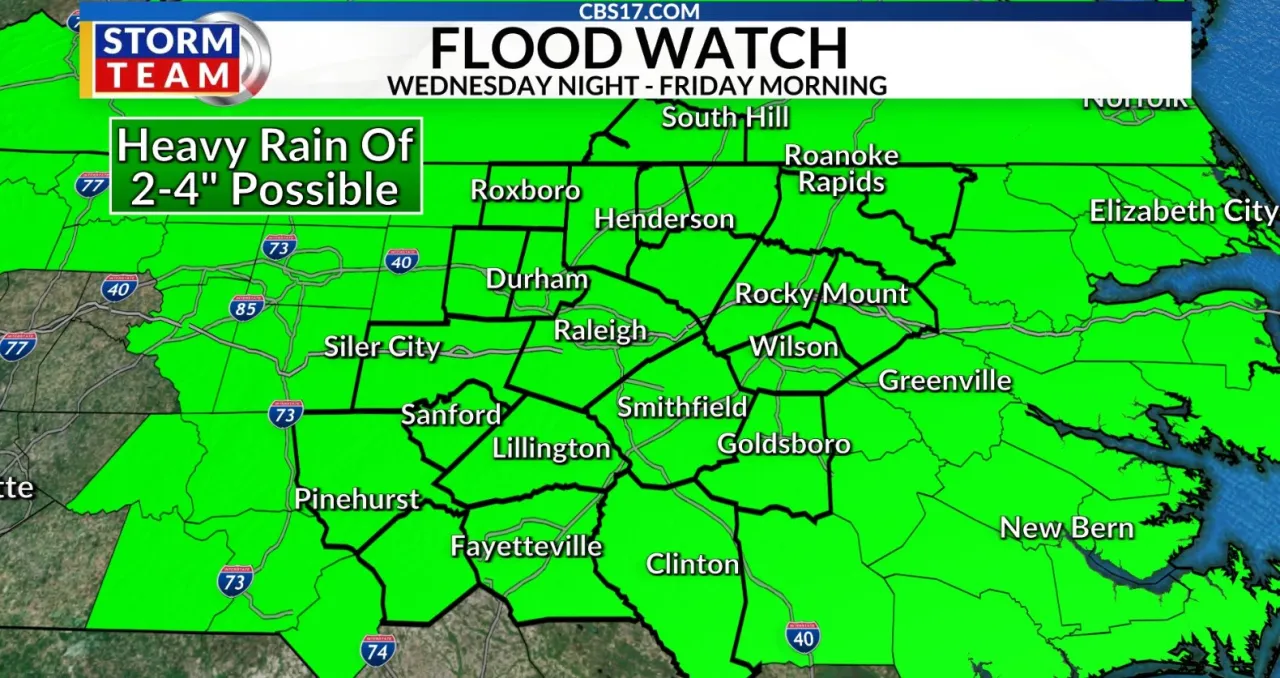
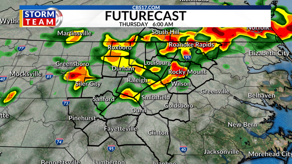
Heavy rain, damaging wind gusts, and isolated tornadoes are possible tonight into Thursday as a slow-moving cold front slides through the area.
Read more Arizona Cardinals offensive lineman Isaiah Adams arrested in Canada on gun charges
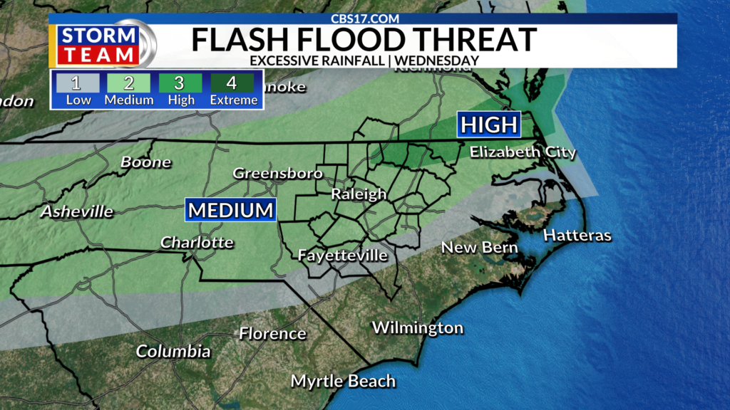
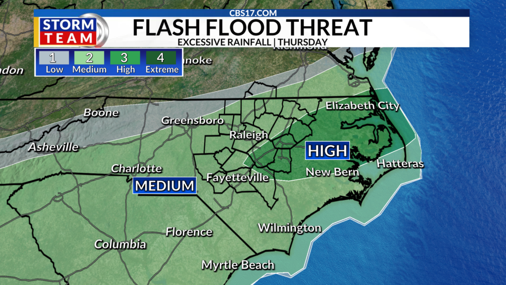
A flood watch is in effect for all of central North Carolina as the risk of flash flooding increases.
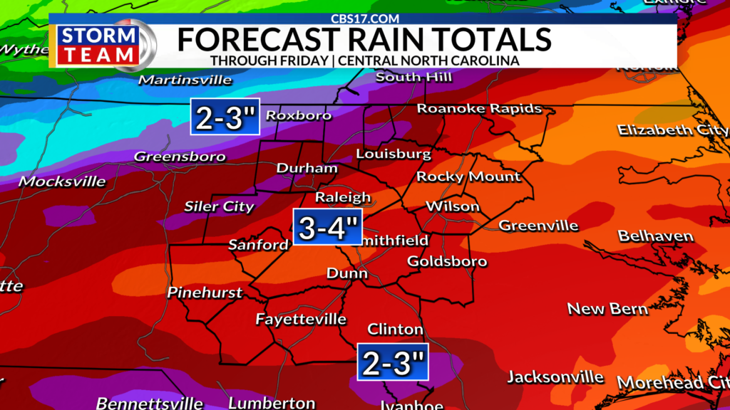
Current forecasts have 2-4 inches of rain falling across the area. Some of that rain could fall during a short period of time, or over an extended period of time. Both of these cause issues for flooding because if it happens quickly, the drains and ground struggle to handle the water and flash flooding occurs quickly.
But if the rain occurs over the same areas over a long timeframe, the ground ends up holding so much water that it can’t hold anymore and the excess rain runs off or puddles, causing more flooding concerns.
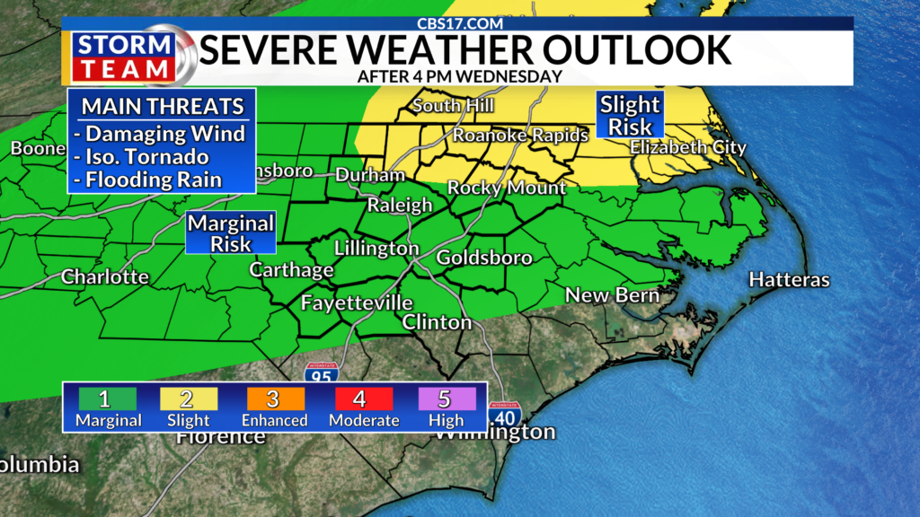
Additionally, as the cold front arrives Wednesday night, it will create a broken line of storms which could also produce damaging winds gusts in addition to an isolated tornado.
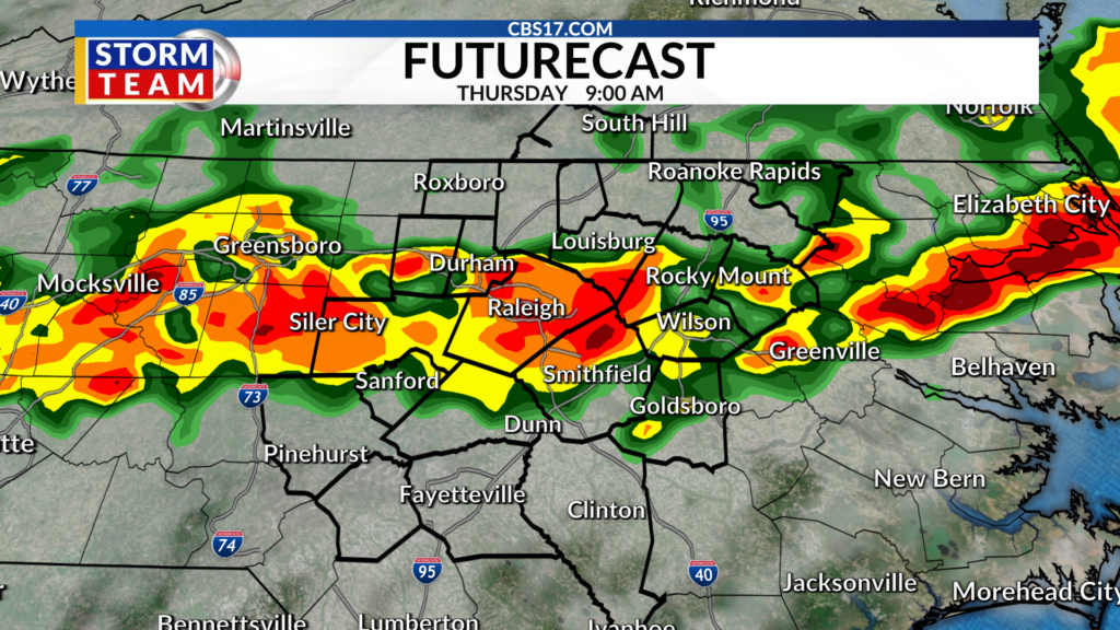
While the risk for damaging wind and tornadoes decreases by Thursday morning, that is when the flooding risk kicks into high gear. As we mentioned above, inches of rain are expected across the area due to the cold front.
The rain will end from north to south, with areas near Virginia drying out by as early as Thursday afternoon, while the southern Coastal Plain and the Sandhills will likely still have persistent rain through Thursday evening, with another round possible Friday morning.
The good news is that behind that front we will see cooler air for a few days. Highs will be in the 80s and overnight lows will fall into the mid 60s for a few days.
Read more Need backup power? Automakers want you to look no further than their vehicles in your driveway
We won’t totally dry out as the front will be close enough that lingering showers will persist off and on through the weekend. The break from the heat will be nice, but next week temperatures return to their typical July levels, in the low 90s.
FORECAST
OVERNIGHT will become stormy with gusty winds and heavy rain. The low will be 70. Winds will be out of the southwest at 10 miles per hour.
THURSDAY will be cloudy with heavy rain during the first part of the day. The high will be 78. Winds will be out of the northeast 5 to 10 miles per hour.
FRIDAY will be partly cloudy with lingering rain south. The high will be 83. Winds will be out of the east 5 to 10 miles per hour.

Follow the CBS 17 Storm Team on socials for the latest weather updates:
Chief Meteorologist Wes Hohenstein: Facebook | X | Instagram
Morning Meteorologist Rachel Duensing: Facebook | X | Instagram
Meteorologist Ross Whitley: Facebook | X | Instagram
Meteorologist Matthew Huddleston: Facebook | X | Instagram
This forecast was prepared by the CBS 17 Storm Team and is based on the latest information available and years of weather forecasting experience in North Carolina. It was not produced by a computer like many forecasts you find on the web, social media and smart phone apps.
Read more Houston Astros ship Nate Pearson to Kansas City after DFA, landing prospect Max Martin