 By admin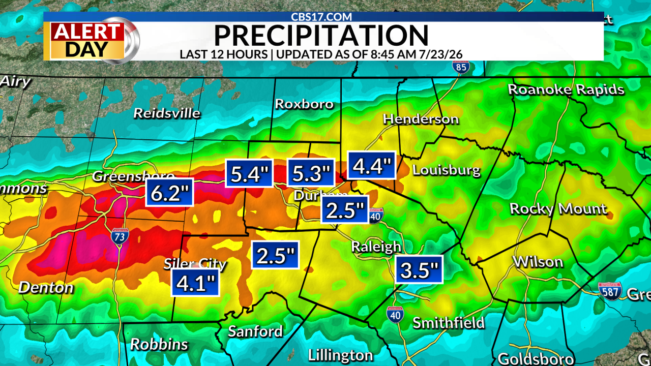
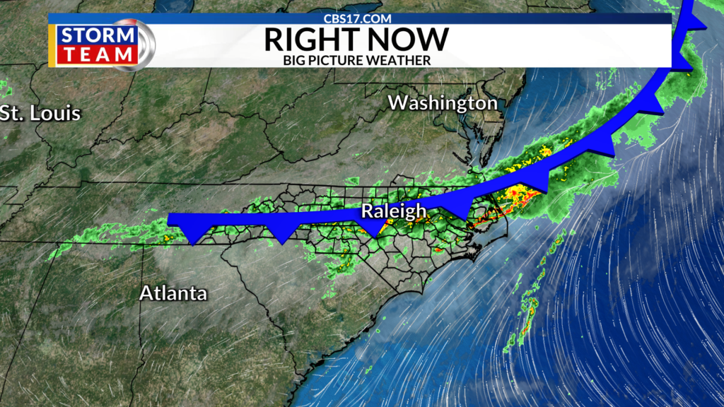
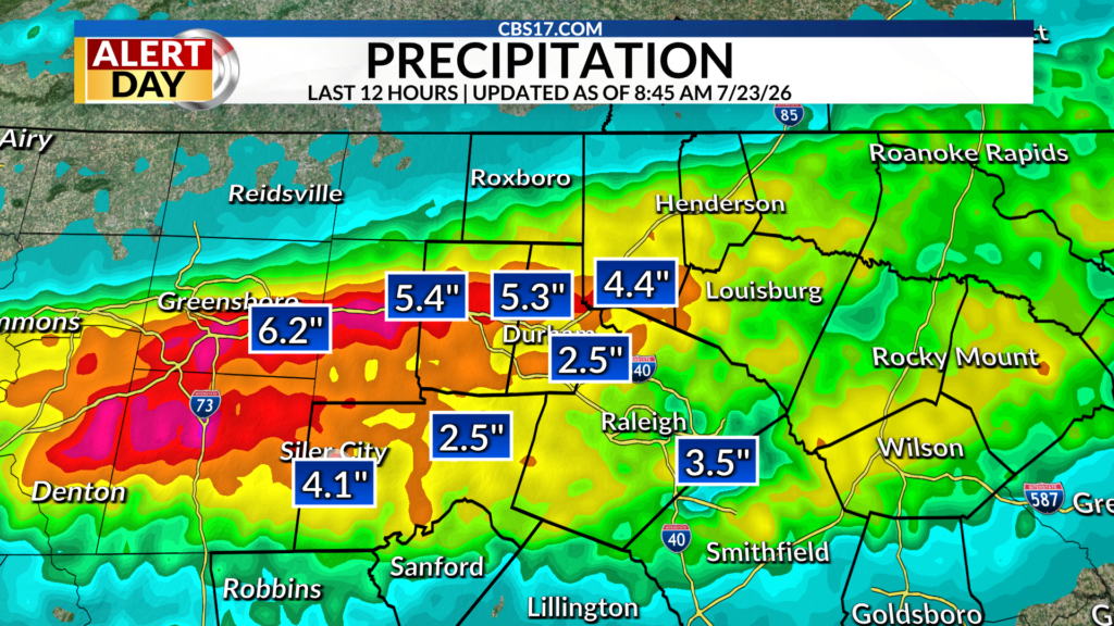
After hours of persistent, and sometimes heavy, rain on Thursday, the slow-moving cold front is slowly moving out of the area.
Read more Senate committee postpones vote on whether to advance CDC director nominee
It will stay close enough overnight that scattered showers will stay in the forecast through the night, but our flooding risk should quickly decrease overnight.
With that being said, the Sandhills and southern Coastal Plain should keep an eye out for ponding rain as more persistent showers could linger into early Friday morning in these locations.
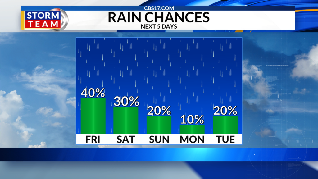
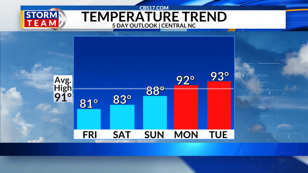
While a few showers are possible Friday and Saturday, what you will most likely notice will be the slight drop in temperatures. Highs will be in the 80s and overnight lows will fall into the 60s both Saturday and Sunday.
As mentioned, we won’t be totally dry as the front will be close enough that moisture could push our way and create a few showers, but the break from the heat will be nice.
Read more Rockies All-Star catcher Hunter Goodman tunes out trade buzz, keeps up power surge as deadline nears
As we enter the last week of July, temperatures will warm back up into the low 90s, with weather typical of late July. This means rain chances, but more spotty chances for rain during the afternoon, unlike what we dealt with today.
FORECAST
OVERNIGHT will be mostly cloudy with scattered showers. The low will be 67. Winds will be out of the north at 5 to 10 miles per hour.
FRIDAY will be mostly cloudy with scattered showers. The high will be 81. Winds will be out of the northeast at 5 miles per hour.
SATURDAY will be partly cloudy with spotty rain. The high will be 83. Winds will be light out of the northeast.
Read more Man City signs England international Elliot Anderson for $155M