 By admin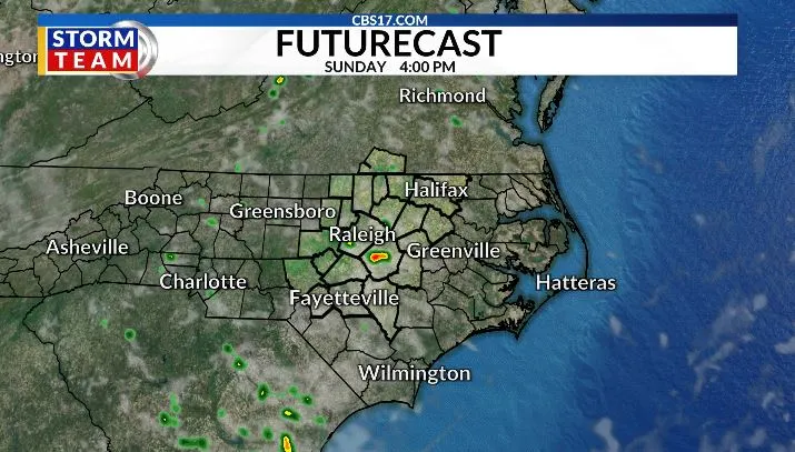
Sunday begins with morning lows in the upper 60s before warming into the middle to upper 80s during the afternoon.
Read more Pogacar poised to win a record-equaling fifth Tour de France title as race enters final stage
Highs reach around 90 degrees on Monday, with increasing humidity making it feel more like a typical late-July day. Monday should remain mostly dry, with only a small chance of an isolated afternoon shower or thunderstorm.
Tuesday is shaping up to be the most active weather day of the week as a cold front approaches from the northwest. Warm, humid air ahead of the front will provide plenty of fuel for thunderstorms, while increasing winds aloft will create an environment supportive of stronger storms. Central North Carolina is currently under a Slight Risk (Level 2 of 5) for severe weather, meaning scattered severe storms are possible.

The primary threat will be damaging straight-line wind gusts, although isolated large hail cannot be ruled out. Torrential rainfall and frequent lightning will accompany many of the storms, and localized flooding could develop where storms repeatedly track over the same areas. The greatest risk appears to be during the late afternoon and evening as the cold front moves across the region.

Behind the front, a refreshing change arrives for the second half of the week. Humidity levels will drop noticeably, and temperatures will ease back into the mid-to-upper 80s on Wednesday and Thursday. The break from the heat won’t last long, however, as warmer and more humid conditions gradually return heading into the first weekend of August.
Looking further ahead, the overall pattern remains fairly typical for late summer, with warm afternoons, seasonable temperatures, and occasional pop-up showers or thunderstorms. The good news is that no prolonged stretch of mid- to upper-90s heat is expected over the next 10 days.
Read more Trial centered on mountaintop castle in Person County ends as judge dismisses claims
FORECAST
SUNDAY will be partly cloudy with a shower or storm in the afternoon/evening. The high will be 86. Winds will be light out of the north.
OVERNIGHT will be partly cloudy and dry. The low will be 68. Winds will become calm.
MONDAY will be mostly clear with a few scattered showers and storms in the area. The high will be 90. Winds will be light out of the west.

Follow the CBS 17 Storm Team on socials for the latest weather updates:
Chief Meteorologist Wes Hohenstein: Facebook | X | Instagram
Morning Meteorologist Rachel Duensing: Facebook | X | Instagram
Meteorologist Ross Whitley: Facebook | X | Instagram
Meteorologist Matthew Huddleston: Facebook | X | Instagram
This forecast was prepared by the CBS 17 Storm Team and is based on the latest information available and years of weather forecasting experience in North Carolina. It was not produced by a computer like many forecasts you find on the web, social media and smart phone apps.
Read more Push to keep daylight saving time & smoke from Canadian wildfires