 By admin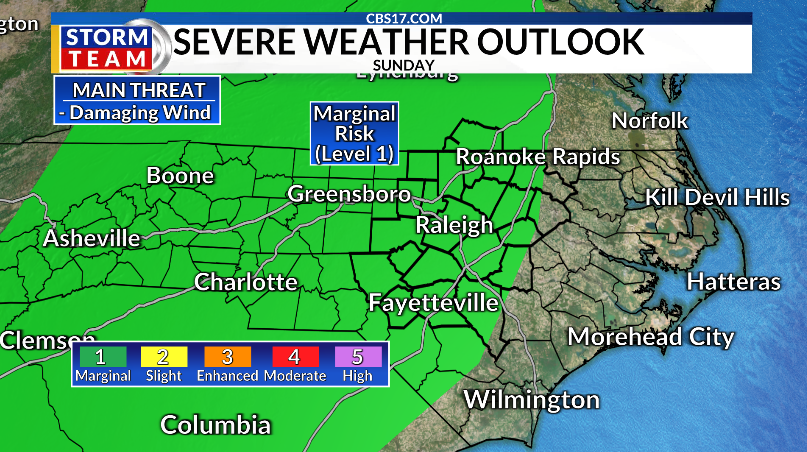
A change in the weather arrives today as moisture begins to return to central North Carolina.
Read more Man seriously hurt in stabbing on Crab Orchard Drive in Raleigh, police say
Rising dew points will make it feel warmer and more humid compared to the past few days, even though afternoon highs will top out in the upper 80s to lower 90s. We’ll also see more clouds than we’ve had recently, but most areas will stay dry, with only a slight chance of a stray afternoon shower.
Rain chances increase on Sunday as a front approaches from the west. The front is expected to slow as it moves into the region, providing enough lift for scattered showers and thunderstorms to develop during the afternoon and evening.
While not everyone will see rain, any storm that forms could produce heavy downpours, frequent lightning, and gusty winds. There will also be enough instability for a few storms to become strong to severe. The Storm Prediction Center has placed central North Carolina under a Marginal Risk (Level 1 of 5) for severe weather, with the primary threat being isolated damaging wind gusts.
The front is forecast to stall nearby on Monday, keeping the chance for scattered showers and thunderstorms in the forecast throughout the day. While Monday currently has the highest rain chances of the upcoming week, it will not be a washout. Expect periods of dry weather between rounds of showers and storms.
The stalled boundary will linger across the region through much of next week, maintaining a daily chance for scattered afternoon and evening thunderstorms. Rain coverage should gradually decrease after Monday, but the combination of warm temperatures and abundant moisture will keep the typical summertime pattern in place across central North Carolina. Temperatures will remain near seasonal averages, with highs around 90 degrees and muggy overnight lows in the lower 70s.
Read more Breakneck pace in immigration courts is driving up deportation orders


FORECAST
SATURDAY will be partly cloudy. The high will be 88. Winds will be out of the south at 10 miles per hour.
OVERNIGHT will be partly cloudy. The low will be 70. Winds will be out of the south at 5 miles per hour.
SUNDAY will be mostly cloudy with spotty showers and storms. The high will be 86. Winds will be out of the south at 10 miles per hour.

Follow the CBS 17 Storm Team on socials for the latest weather updates:
Chief Meteorologist Wes Hohenstein: Facebook | X | Instagram
Morning Meteorologist Rachel Duensing: Facebook | X | Instagram
Meteorologist Ross Whitley: Facebook | X | Instagram
Meteorologist Matthew Huddleston: Facebook | X | Instagram
This forecast was prepared by the CBS 17 Storm Team and is based on the latest information available and years of weather forecasting experience in North Carolina. It was not produced by a computer like many forecasts you find on the web, social media and smart phone apps.
Read more Russia hits Ukrainian capital with ballistic missiles and drones, killing at least 9