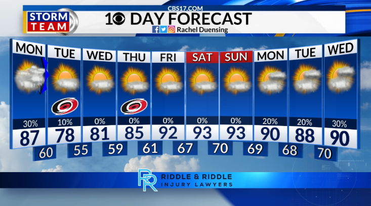
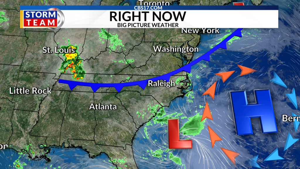
As the only cold front this week slowly slides through central North Carolina on Monday night, get ready for a comfortable few days before the heat builds back in by the end of the month. The slow-moving front will keep clouds and a stray shower around Tuesday morning, before the dry air finally takes over, clearing the skies for a partly cloudy Tuesday afternoon.
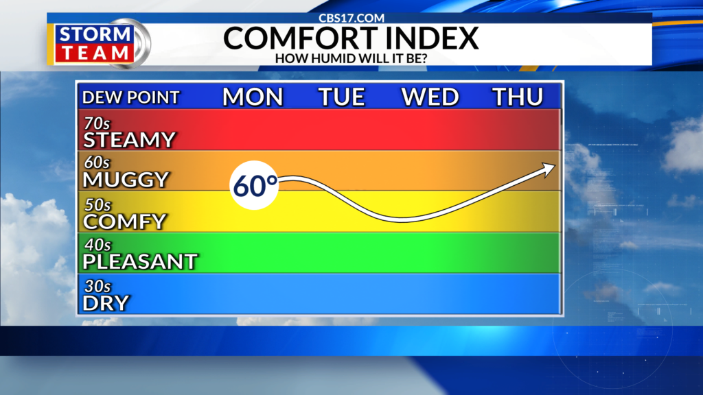
Temperatures will be cooler than average in the upper 70s and humidity will be low and comfortable. Great news for any Caniacs tailgating or going to watch parties ahead of Game 1 of the Stanley Cup Final.
Wednesday morning will be much cooler, down into the 50s, before we slowly warm back up by the afternoon. Highs will reach the low 80s on Wednesday and then the mid-80s on Thursday. That’s the only break from the heat we get as highs climb quickly for Friday and the weekend.
A strong ridge of high pressure will develop in the middle levels of the atmosphere, which will suppress rain chances but allow our temperatures to climb quickly. Expect hot and humid weather through the weekend with highs reaching the mid-90s. A few showers are possible next week as the pattern shifts slightly, but we will still stay warmer than average in the 90s.
FORECAST
OVERNIGHT will be mostly cloudy. The low will be 60. Winds will be 5 to 10 miles per hour out of the north.
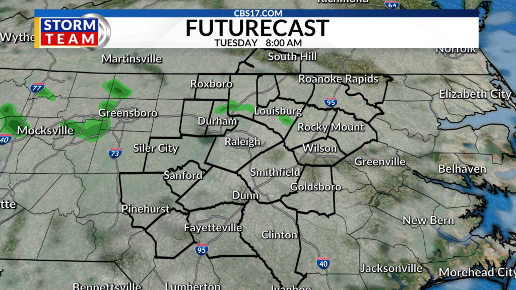
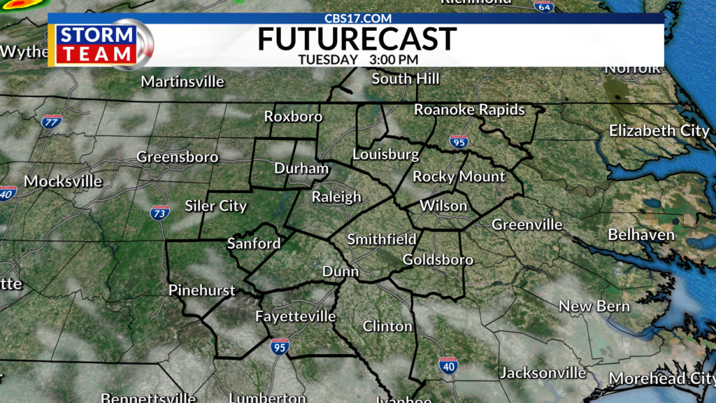
TUESDAY will be mostly cloudy with a stray shower in the morning, then partly cloudy in the afternoon. The high will be 78. Winds will be 10 to 15 miles per hour out of the northeast.
WEDNESDAY will be partly cloudy. The high will be 81. Winds will be 5 to 10 miles per hour out of the north.