The most intense heat wave of the season so far is underway, with the hottest and most dangerous temperatures and humidity peaking Saturday for the Fourth of July.
Read more Jaylen Brown still processing how he became a former Boston Celtic after stunning trade with 76ers
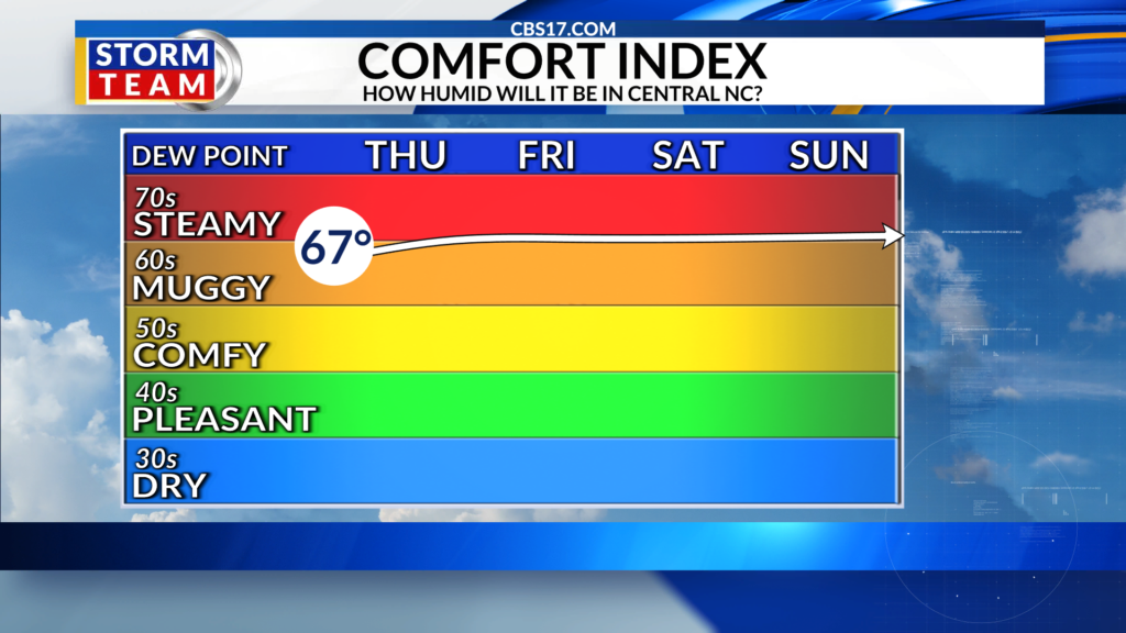
Highs will climb to between 100 to 103 for multiple days in a row, with the high humidity making it feel even hotter.
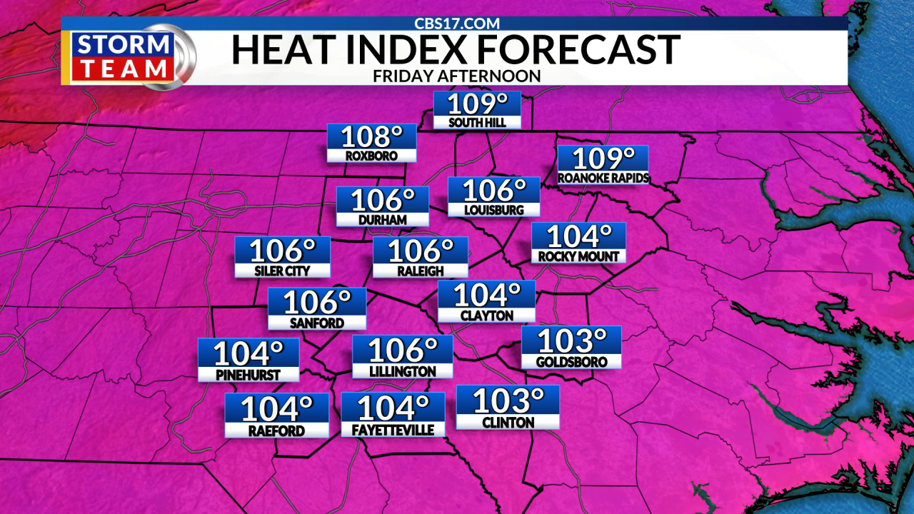
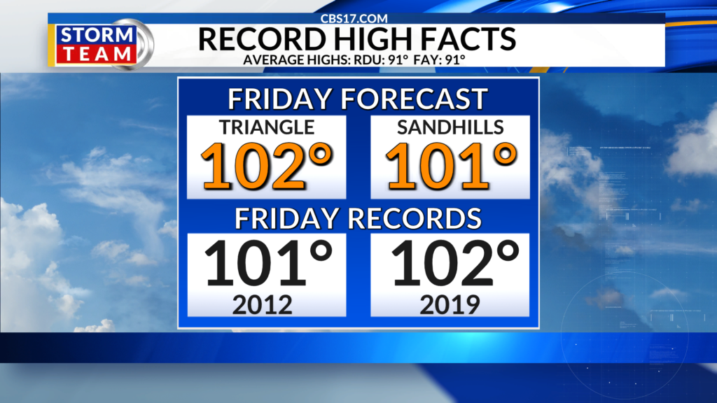
Friday afternoon will climb into the triple digits with highs up around 102 degrees and heat index values as high as 106. While we do expect to stay mainly dry, a stray shower is possible near the Virginia state line, mainly late in the day.
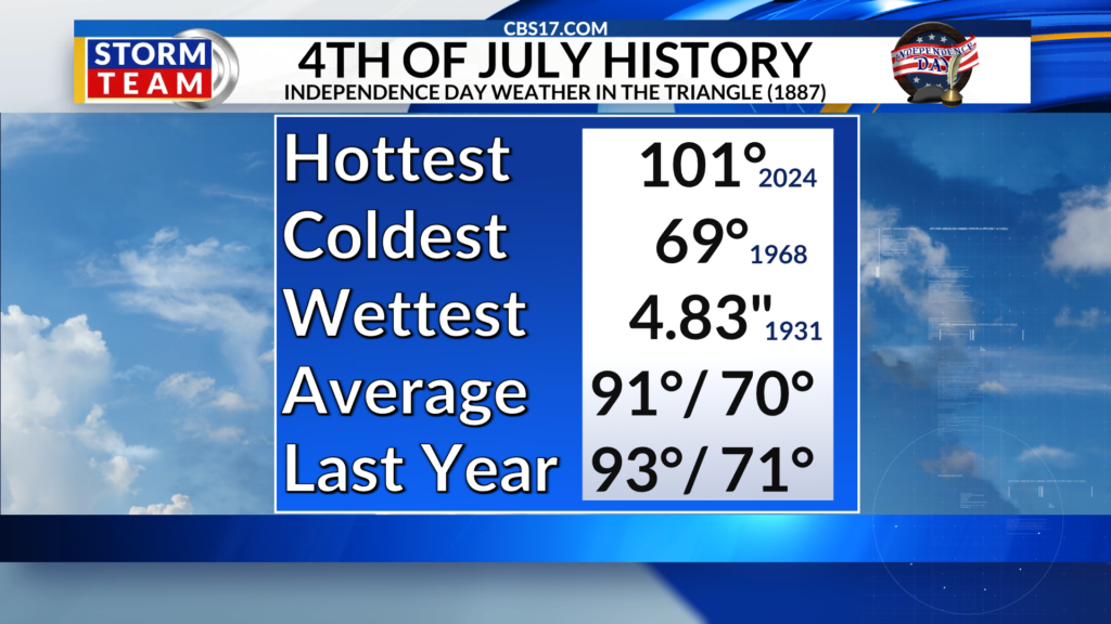
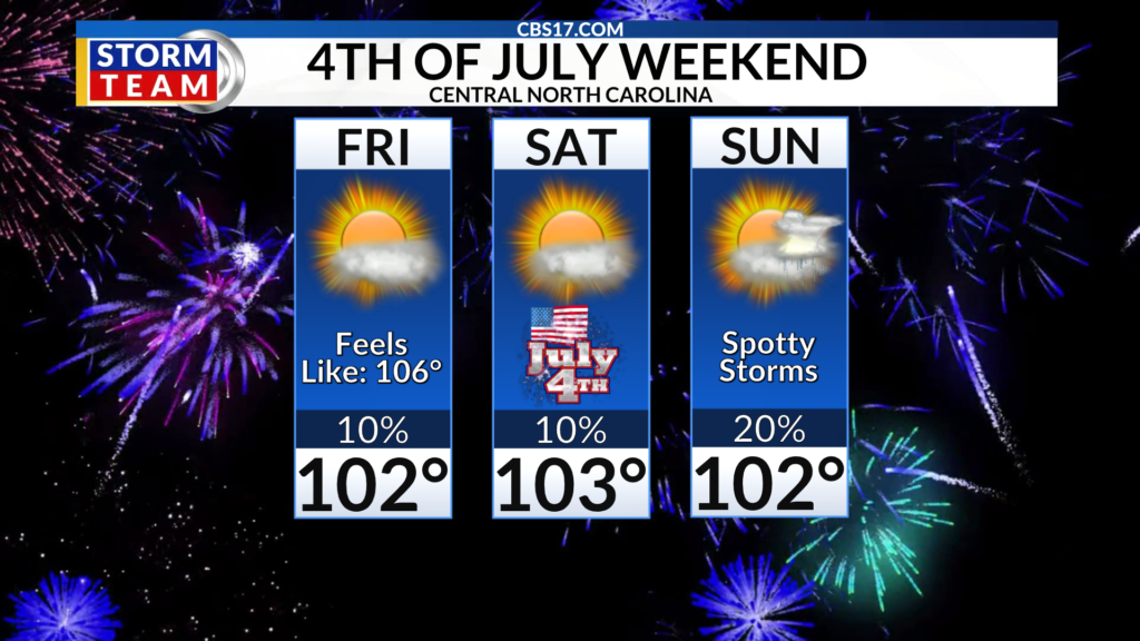
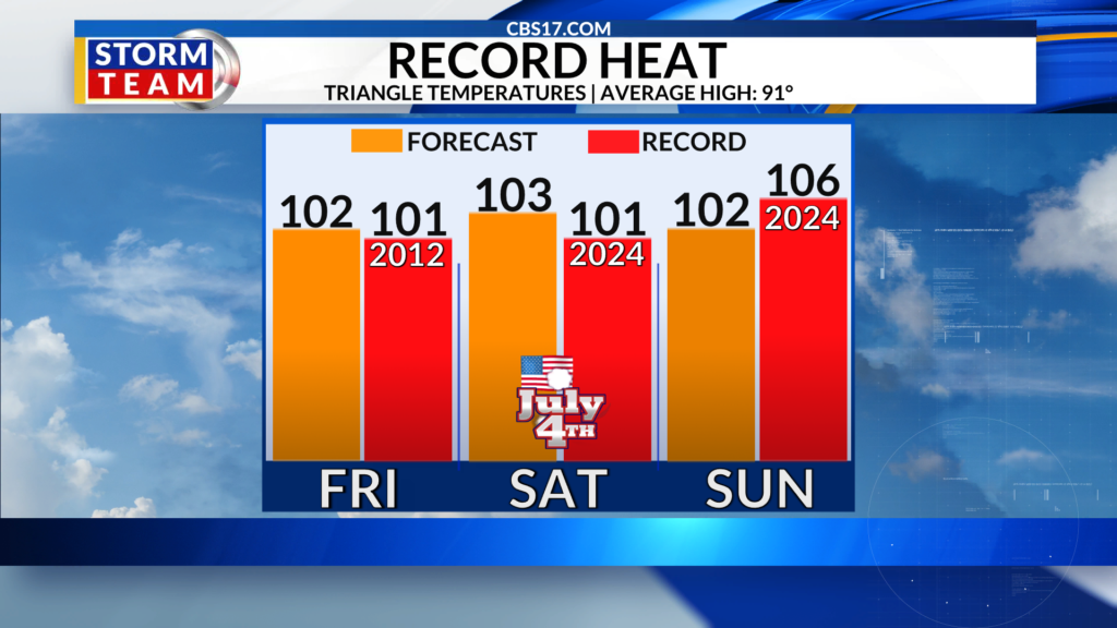

That trend of 100+ heat will last through the holiday weekend. We’ll likely easily set the record for the hottest July 4th ever for Raleigh with a current forecast of 103, which would break the previous record of 101 set back only in 2024. Expect highs to stay around 100 through Monday.
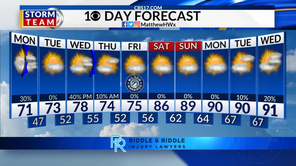
90s return to the forecast next week as the strong high pressure bringing us the extreme heat breaks down. This will also bring an increased chance for rain, but unfortunately, the rain chances aren’t expected to be widespread at this time. The good news is that temperatures will return to normal, the low 90s, by the middle of the week.
FORECAST
OVERNIGHT will be mostly clear. The low will be 73. Winds will be south at 5 miles per hour.
FRIDAY will be partly cloudy and very hot. The high will be 102 with a heat index of 106. Winds will be light out of the south.
SATURDAY will be partly cloudy and very hot. The high will be 103 with a heat index of 108. Winds will be south at 5 miles per hour.
Follow the CBS 17 Storm Team on socials for the latest weather updates:
Chief Meteorologist Wes Hohenstein: Facebook | X | Instagram
Morning Meteorologist Rachel Duensing: Facebook | X | Instagram
Meteorologist Ross Whitley: Facebook | X | Instagram
Meteorologist Matthew Huddleston: Facebook | X | Instagram
This forecast was prepared by the CBS 17 Storm Team and is based on the latest information available and years of weather forecasting experience in North Carolina. It was not produced by a computer like many forecasts you find on the web, social media and smart phone apps.
Read more Caitlin Clark voted to start third straight WNBA All-Star Game, joined by two Fever teammates