 By admin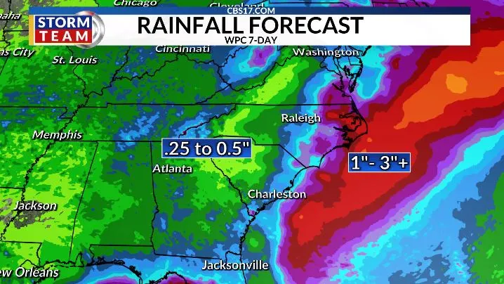
The hottest temperatures in a while will be around for Thursday through the weekend. Highs through Saturday are expected to soar into the upper 90s, with heat index values well over 100 degrees.
Read more Girl drowns in Durham, police say
Thursday afternoon will feature mostly clear skies, with the exception of hazy skies high in the atmosphere due to wildfire smoke filtering down from Canada. Highs are still expected to near record values in the upper 90s to around 100 degrees, with a feels-like temperature approaching 105.
Friday will be just a hot. Skies will again be mostly clear, with slightly less haze. Another round of record temperatures is possible.
A final day of intense heat is in store for Saturday before rain chances keep highs in the lower 90s on Sunday into early next week.
No day will be a complete washout, but scattered showers and storms will become likely again on any given afternoon.
Read more India’s Gen Z ‘cockroaches’ took protest to the streets. Now they rally around a hunger strike
We’re watching for a potential area of low pressure to ride up the southeast coast. NHC has given it low-end tropical development odds. Regardless, we could see more or less rain depending on the track.


FORECAST
OVERNIGHT will be mostly clear. The low will be 72. Winds will be light out of the south.
THURSDAY will be sunny, other than lots of upper-level haze from Canadian wildfire smoke. The high will be 98 with a heat index of 104. Winds will be out of the south at 5 miles per hour.
FRIDAY will be mostly clear, with less haze overhead. The high will be 98 with a heat index of 107. Winds will be out of the east at 5 miles per hour.
Read more Downtown Raleigh restaurants step up sanitation protocols ahead of Restaurant Week