 By admin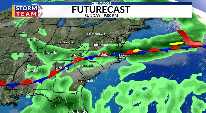
The stretch of dangerous heat continues through Friday and Saturday as a strong upper-level ridge remains in control across the Southeast. Temperatures will climb into the upper 90s both days, and increasing humidity will push heat index values above 105° during the afternoon.
Read more A former prime minister who led Israel out of Lebanon fears mistakes are being repeated
While the ridge begins to weaken late in the weekend, it won’t happen quickly enough to provide much relief from the heat. Friday will be the quieter of the two days. Most communities will stay dry with plenty of sunshine, although an isolated shower or thunderstorm could develop late in the afternoon or evening. Wildfire smoke will be present in the air again through the day and could lower air quality once again.
Saturday brings another day of oppressive heat, but the atmosphere also becomes more favorable for thunderstorms by late afternoon and evening. A typical summertime lee trough developing east of the Appalachians will act as a focus for storm development. While much of the day will remain dry, any storms that form could become strong to severe, with damaging wind gusts being the primary threat. If you have evening plans, keep a close eye on the forecast.
Sunday has the highest chance for widespread showers and thunderstorms as deeper tropical moisture streams northward into the Carolinas. A weak area of low pressure may develop along the Southeast coast, and the National Hurricane Center is giving it only a low (20%) chance of tropical development. Whether it becomes tropical or not is less important than the moisture it brings.
As that moisture interacts with an approaching cold front from the north, the setup could support numerous showers and thunderstorms, with some capable of producing damaging winds, torrential rainfall, and frequent lightning. Sunday currently appears to be the most active weather day of the forecast, so be prepared for changing conditions if you have outdoor plans. The unsettled weather could continue later into next week, depending on how the trough and the low across the southeast shape up.
Read more Israel’s parliament dissolves ahead of Oct. 27 elections
Behind the front, temperatures ease back closer to normal for the start of next week. Highs return to the lower 90s with the familiar summertime pattern of warm, humid afternoons and isolated to scattered thunderstorms each day.


FORECAST
FRIDAY will be partly cloudy with a stray shower late. The high will be 98 with a heat index of 107. Winds will be out of the east at 5 miles per hour.
OVERNIGHT will be mostly clear. The low will be 76. Winds will be light out of the south.
SATURDAY will be partly cloudy with storms in the evening. The high will be 97 with a heat index of 107. Winds will be out of the south at 5 to 10 miles per hour.
Read more Landslide in southwest China traps people, rescue efforts underway