 By admin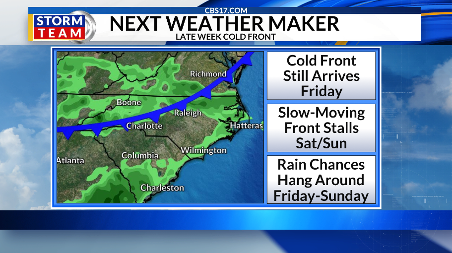
There’s a cold front on the way, but not before intense heat makes a comeback.
Highs by Thursday will climb into the lower to mid-90s, with higher humidity making it feel like around 100 degrees. The cold front arrives on Friday, ushering in cooler but not cold air by any means.
Read more $1 million bond for man charged in Wake County hit-and-run that killed child
The front will be a slow-mover. It will hang around the area through Sunday. This will help spark daily rain chances, especially on Saturday. Local college football games may have to dodge some scattered showers and storms from Friday into Saturday.
It turns drier on Monday into the next week. But highs remain in the upper 80s and lower 90s all across the 10-day.
The peak of hurricane season arrives Thursday. But you wouldn’t know it by looking at the tropics. The Atlantic basin remains unusually quiet, with no storms expected at least for the next 7 days.
North Carolina has seen multiple impactful tropical systems well after the historical peak. So it’s important to keep a close eye on things until hurricane season officially ends in November.


FORECAST
WEDNESDAY will be mostly sunny and warmer. The high will be 88. Winds will be light and variable.
Read more Multiple cars broken into at Durham hotel on Mount Moriah Road, police say
OVERNIGHT will be mostly clear and cooler. The low will be 64. Winds will be out of the south at 5 miles per hour.
THURSDAY will be mostly sunny and hot. The high will be 94 with a heat index around 100. Winds will be out of the southwest at 5 to 10 miles per hour.

Follow the CBS 17 Storm Team on socials for the latest weather updates:
Chief Meteorologist Wes Hohenstein: Facebook | X | Instagram
Morning Meteorologist Rachel Duensing: Facebook | X | Instagram
Meteorologist Ross Whitley: Facebook | X | Instagram
Meteorologist Matthew Huddleston: Facebook | X | Instagram
This forecast was prepared by the CBS 17 Storm Team and is based on the latest information available and years of weather forecasting experience in North Carolina. It was not produced by a computer like many forecasts you find on the web, social media and smart phone apps.
Read more Nepal’s flood disaster and the impact of climate change loom large in the icy shadow of Mont Blanc