 By admin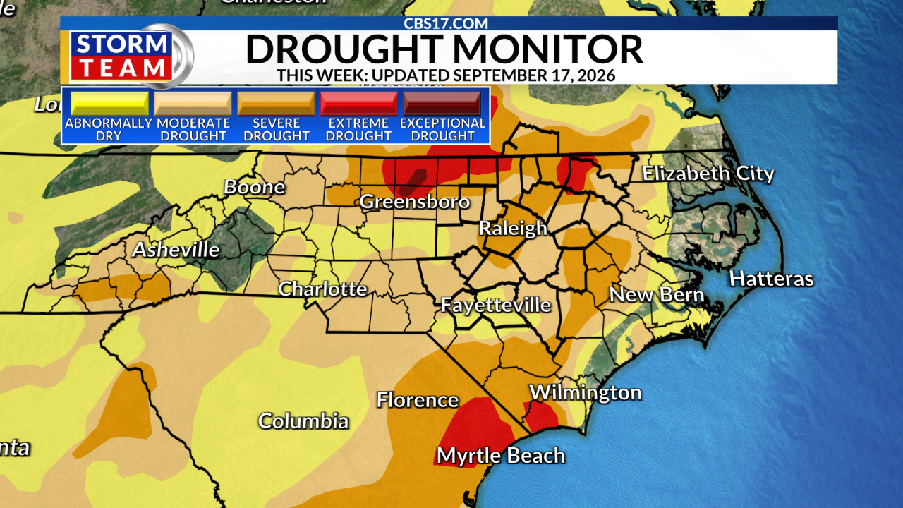
RALEIGH, N.C. (WNCN) — With less than a half inch of rain falling across the Triangle since Sunday, severe drought (D2) has returned to more of central North Carolina. Additionally, only five days this month have recorded measurable rain, leading to an increasing rain deficit across the area.
Read more Spying scandal is still haunting Southampton as Reynolds and Wrexham continue the pile-on
There are a few small sections of the state currently enjoying no drought, mainly along the Outer Banks and the in lee of the Mountains. But the drought has gradually worsened across the state, including here in central North Carolina.
The worst drought locally includes western Halifax County, eastern Warren County, northern Person County, and northwestern Granville County, which are all in an extreme drought (D3).

There is hope that we could see more measurable rain through the end of the month. An active pattern is setting up which will bring in multiple cold fronts, allowing potentially more rain across our area. While it may not bust the drought, it would at least help with some of the temporary dry conditions across central North Carolina.
Read more UNC defensive coordinator Steve Belichick resigns, probe into conduct in football program concludes

Unfortunately, the Climate Prediction Center is calling for “equal chances” in terms of precipitation for next month, October. This means that forecast solutions don’t lean heavily toward a drier-than-average or wetter-than-average month.
An average October for the Triangle brings just under 3.5 inches of rain, and unfortunately, we would need nearly 5 times that amount of rain to totally erase the drought during the month of October.

A cold front could bring rain Friday and this weekend, in addition to early next week. Stay up to date with your CBS17 forecast as we wait for our best chances for rain.