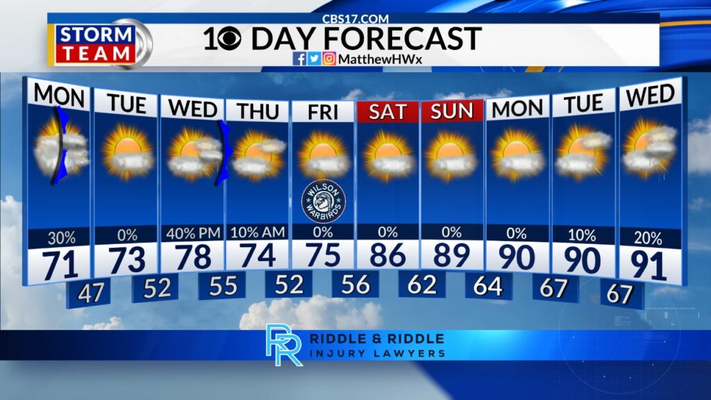
Any lingering showers come to an end overnight as a cold front helps to clear out clouds for a mostly clear start to the work week. Monday morning begins in the lower 70s but only tops out in the upper 80s to around 90 degrees. Still warm, but much cooler than recently.
Read more Rod Brind’Amour’s Hurricanes just 60 minutes from a Stanley Cup
The coolest day of the week comes on Tuesday, with middle to upper 80s before heat and humidity return again by midweek. Highs on Wednesday will reach the middle 90s with upper 90s on Thursday, threatening record highs again.
The best rain chances of the week comes on Friday, but it’ll still be hot with middle 90s.

Lower 90s settle in through Father’s Day Sunday and into early the next week, with scattered showers and storms each day.
FORECAST
OVERNIGHT will see gradually clearing skies. The low will be 73. Winds will be 5 to 10 miles per hour out of the south.
Read more 11 skydivers, pilot killed after plane crashes south of Kansas City
MONDAY will be mostly clear and much cooler. The high will be 89. Winds will be 5 to 10 miles per hour out of the northwest.
TUESDAY will be mostly cloudy and seasonable with a few scattered showers. The high will be 87. Winds will be 5 miles per hour out of the northeast.
Follow the CBS 17 Storm Team on socials for the latest weather updates:
Chief Meteorologist Wes Hohenstein: Facebook | X | Instagram
Morning Meteorologist Rachel Duensing: Facebook | X | Instagram
Meteorologist Ross Whitley: Facebook | X | Instagram
Meteorologist Matthew Huddleston: Facebook | X | Instagram
This forecast was prepared by the CBS 17 Storm Team and is based on the latest information available and years of weather forecasting experience in North Carolina. It was not produced by a computer like many forecasts you find on the web, social media and smart phone apps.
Read more Germany surges to a 3-1 halftime lead as Curacao nets its 1st World Cup goal