Extreme heat returns to the forecast to start July with multiple days reaching at least 100 degrees, but before the extreme heat, strong and severe storms are possible this weekend in central North Carolina.
Read more East Durham driver’s license office temporarily closed because of bed bugs, NCDOT says
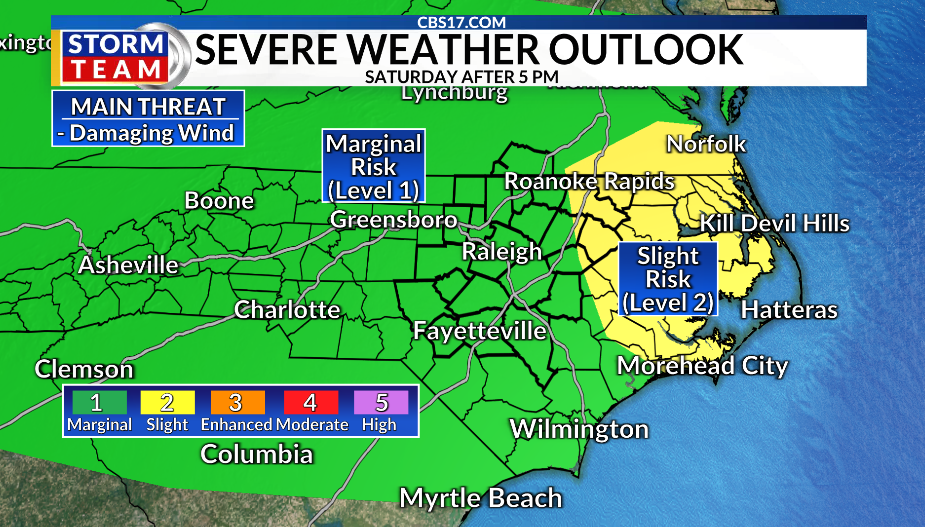
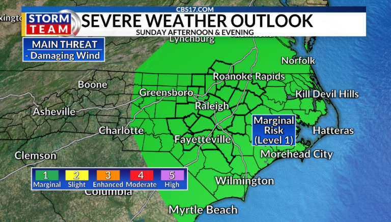
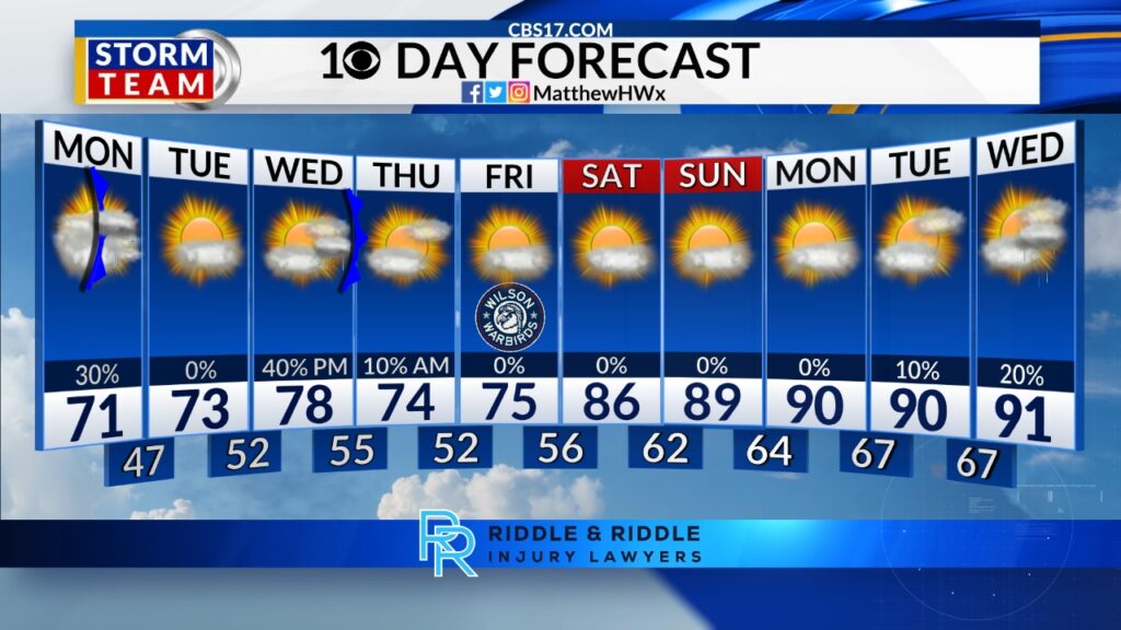
While both days this weekend could see storms, Saturday has the best chance for stronger storms. The heat and increasing humidity will create an environment where storms are capable of producing damaging wind gusts mainly in the late afternoon and evening. This threat has resulted in a level 1, marginal risk of severe weather for all of central North Carolina later Saturday. A small portion of eastern North Carolina, east of I-95 is at a slight risk (Level 2 of 5) for severe weather.
Any storm that develops could bring heavy downpours, frequent lightning, and gusty winds. While summertime storms are common this time of year, this threat looks to be higher than that of our garden variety storms, so pay attention to the forecast, especially if you have outdoor plans. Our more typical, summertime storms are expected Sunday afternoon.
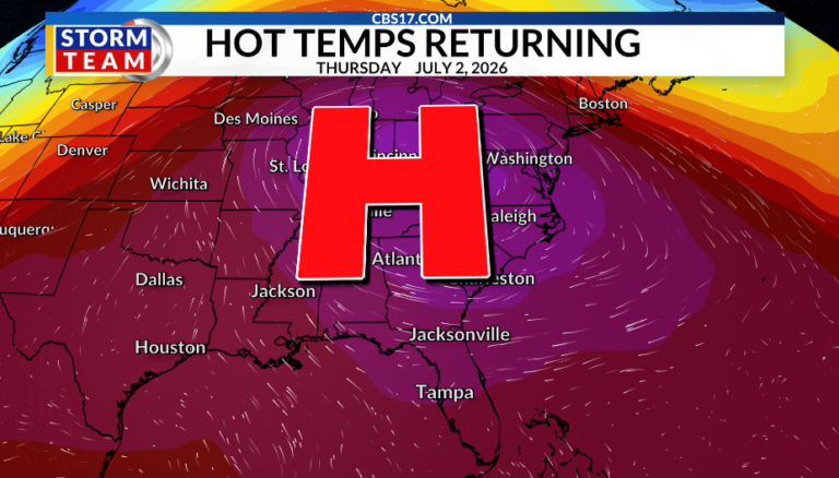
After this weekend our rain chances go down and our temperatures go way up. A strong ridge of high pressure will center over the Mississippi and Ohio River Valleys. This will create a large dome of very hot temperatures that will extend as far east as North Carolina, allowing our temperatures to soar to dangerous heights. Temperatures climb to 95 with dry weather next Tuesday.
High temperatures will reach near 100 degrees multiple days in a row starting next Wednesday and lasting through the 4th of July. As you plan for your holiday weekend, have ways to stay hydrated, stay cool and safe as many will be outside. Eventually storms will develop, mainly Friday and Saturday of next week.

FORECAST
OVERNIGHT will become mostly clear. The low will be 73. Winds will be out of the south at 5 to 10 miles per hour.
Read more Tens of thousands expected to attend annual ‘Out! Raleigh Pride’ festival
SATURDAY will be partly cloudy with strong storms later in the day and evening. The high will be 92. Winds will be southwest at 10 miles per hour.
SUNDAY will be partly cloudy with isolated storms. The high will be 93. Winds will be west at 10 miles per hour.
Follow the CBS 17 Storm Team on socials for the latest weather updates:
Chief Meteorologist Wes Hohenstein: Facebook | X | Instagram
Morning Meteorologist Rachel Duensing: Facebook | X | Instagram
Meteorologist Ross Whitley: Facebook | X | Instagram
Meteorologist Matthew Huddleston: Facebook | X | Instagram
This forecast was prepared by the CBS 17 Storm Team and is based on the latest information available and years of weather forecasting experience in North Carolina. It was not produced by a computer like many forecasts you find on the web, social media and smart phone apps.