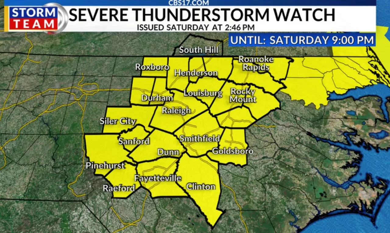
RALEIGH, N.C. (WNCN) — As some central North Carolina counties were under a severe thunderstorm warning Saturday afternoon, the National Weather Service issued a severe thunderstorm watch for many counties until 9 p.m.
Read more No budget, no raises: July 1 pay bumps likely delayed for NC teachers, state employees and retirees
Just before 3:30 p.m., a severe thunderstorm was located near Zebulon, or 18 miles north of Smithfield, moving east at 20 mph.
With threats from 60 mph wind gusts and nickel-sized hail, a severe thunderstorm warning was issued until 4:30 p.m. for the following counties:
- North central Wayne County
- Southwestern Nash County
- East central Wake County
- Wilson County
- Northeastern Johnston County
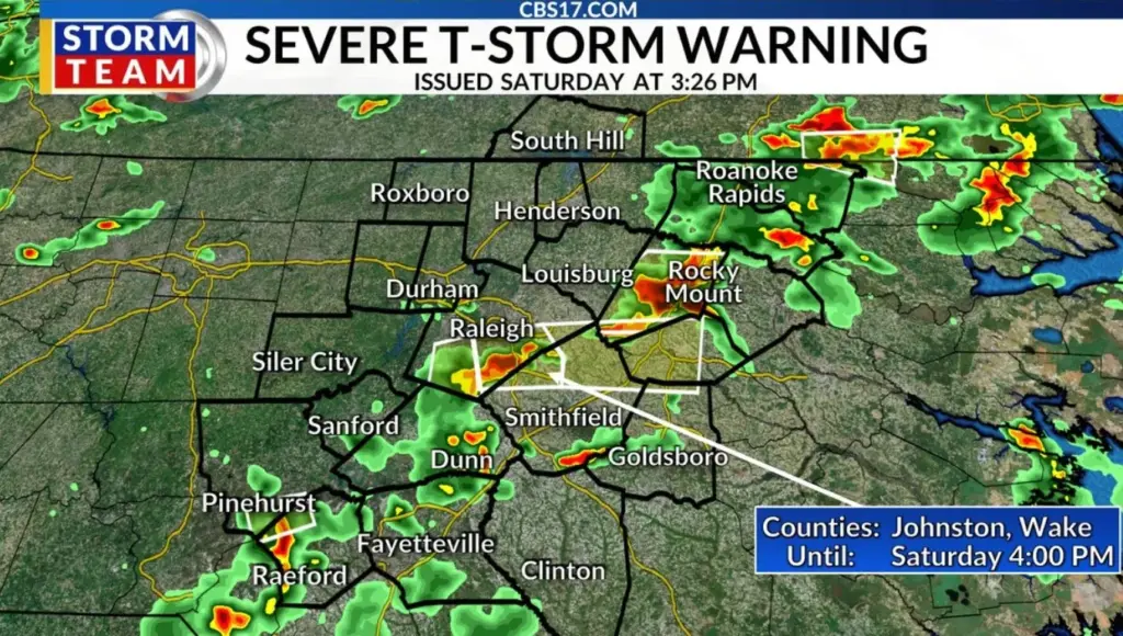
Around 3 p.m., a severe thunderstorm warning was issued for Nash County and southeastern Franklin County until 3:45 p.m.
Read more Some paid the ultimate price to enact voting rights. Their survivors see America turning backward
The severe thunderstorm watch was issued just before 3 p.m. for 21 North Carolina counties. In the Raleigh area, those counties include:

- Chatham
- Cumberland
- Durham
- Edgecombe
- Franklin
- Granville
- Halifax
- Harnett
- Hoke
- Johnston
- Lee
- Moore
- Nash
- Orange
- Person
- Sampson
- Vance
- Wake
- Warren
- Wayne
- Wilson
National Weather Service forecasters said that damaging straight-line wind gusts and locally heavy downpours will be the primary hazards. Lightning is possible with any thunderstorm.
Read more Militant rams explosive-laden vehicle into paramilitary headquarters in Pakistan