 By admin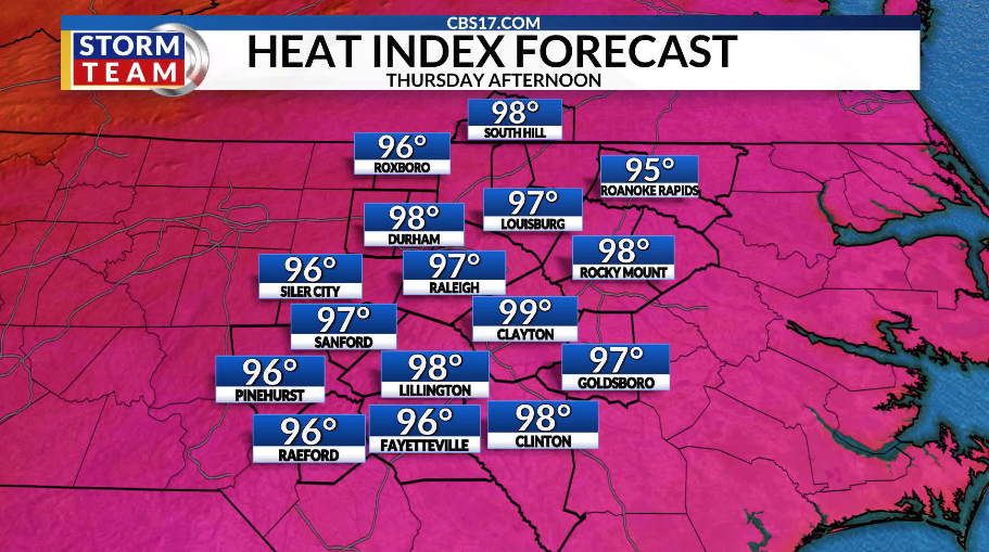
Temperatures in the toasty lower to middle 90s are returning. Thursday and Friday will be hot ahead of a cold front later in the day Friday. The front will spark scattered showers and storms through the weekend as it slows down and stalls across the region.
Read more Astros’ Jose Altuve doubles in 3rd inning vs. Phillies for 2,500th career hit
Most spots are expecting around 0.50” to 0.75” of rain. But a few locations could pick up 1”+, depending on where the heaviest bands set up.
Even behind the cold front, temperatures will remain above average. Highs settle into the upper 80s and lower 90s into the next week as the pattern starts to turn drier again, with high pressure building in.
The peak of hurricane season arrives Thursday. But you wouldn’t know it by looking at the tropics. The Atlantic basin remains unusually quiet, with no storms expected at least for the next 7 days. North Carolina has seen multiple impactful tropical systems well after the historical peak. So it’s important to keep a close eye on things until hurricane season officially ends in November.
Read more Rivals Angel Reese and Caitlin Clark having ‘fun’ playing together for US and not against each other


FORECAST
THURSDAY will be mostly sunny and hot. The high will be 94. Winds will be out of the southwest at 5 to 10 miles per hour.
OVERNIGHT will be partly cloudy. The low will be 72. Winds will be southwest at 5 to 10 miles per hour.
FRIDAY will be partly cloudy and hot with scattered showers and storms, mainly in the afternoon and the evening. The high will be 94 with a heat index around 100. Winds will be light out of the southwest.
Read more A sudden IL stint for Shohei Ohtani, and an unprecedented Double-A call-up to fill his spot