 By admin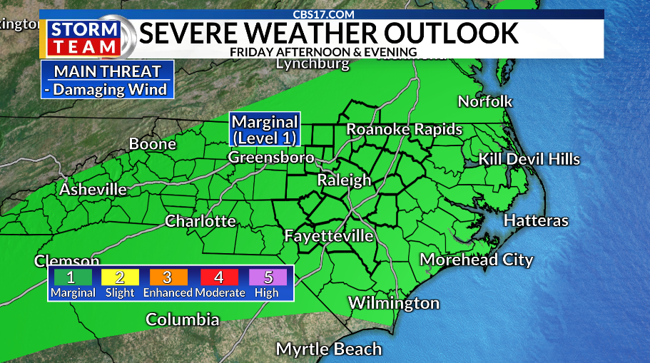
We’re trading out our sunny, comfortable weather for higher humidity and rain chances. A late-week cold front will bring scattered showers and storms, especially on Friday, with the risk of isolated flooding and damaging winds.
Dew points will rise throughout Thursday and Friday, with upper 80s on both days. That sets the stage for the rain on both days. Behind the cold front, it’ll gradually turn drier and cooler on Saturday, with temperatures in the mid-80s.
But as we flip the calendar from August to September, a return of intense heat arrives.
Highs through the first few days of the new month will reach the lower to mid-90s, with heat index values over 100 degrees. Rain chances will go the opposite way, as high-pressure ridges move in.
Read more Chinese foreign minister calls for US and China to ‘overcome obstacles’ ahead of presidential summit
Beyond central North Carolina, we’re watching an area of disturbed weather around 3,000 miles away. It has a 60 percent chance of tropical formation over the next two days as it drifts west and northwest. Models eventually have it being torn apart by wind shear. But, as always, we’ll keep a close eye on it and keep you up to date with any changes.
FORECAST
THURSDAY will be mostly sunny. There will be a few scattered showers. The high will be 89. Winds will be out of the south at 5 miles per hour.
OVERNIGHT will be partly cloudy. The low will be 71. Winds will become calm.
FRIDAY will be partly cloudy. There will be scattered showers and storms as a cold front moves in. The high will be 87. Winds will be light out of the south.
Read more After six months of Iran war, US goals have shifted. The Strait of Hormuz is now a top concern