 By admin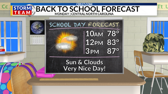
A much more comfortable air mass has settled into central North Carolina following Sunday’s cold front.
Read more Two Phoenix police officers arrested and fired after violent, unreported traffic stop
Temperatures are in the mid-80s, but the bigger difference is the drop in humidity, with dew points falling into the 50s and 60s. A northwest breeze will keep the air noticeably drier through Monday, making for some excellent late-August weather.
Monday morning starts near the mid-60s before temperatures climb into the upper 80s during the afternoon. A stray shower is possible across the Sandhills tonight, but most of central North Carolina should stay dry.
The comfortable weather will continue into Tuesday, with temperatures again reaching the upper 80s before humidity and moisture begin to increase Wednesday and Thursday.
Rain chances will gradually rise, with the best opportunity for showers and thunderstorms arriving Thursday as a weakening boundary moves into the region. Some areas could pick up locally heavy rainfall, while others may see little or nothing.
Temperatures will gradually warm through the week, approaching 90 degrees by the weekend, but the overall pattern remains much more comfortable than the recent stretches of excessive heat.
The tropics also deserve attention as we enter the climatological peak of hurricane season. A tropical wave moving off the coast of Africa has roughly a 50% chance of development, making it the feature to watch over the next week or more.
Read more Sean Grayson, former Illinois deputy convicted of killing Sonya Massey, dies in prison, lawyer says
Another wave farther west in the Atlantic could briefly become more organized over the next couple of days, but it has a long way to travel and is not currently considered a threat to the U.S. Most of the guidance keeps these systems away from the mainland, but this is the time of year when tropical activity typically increases, so we’ll continue watching the Atlantic closely.

FORECAST
MONDAY will be partly cloudy to mostly sunny. The high will be 88. Winds will be out of the northwest at 5 miles per hour.
OVERNIGHT will be mostly clear. The low will be 65. Winds will be south at 5 miles per hour.
TUESDAY will be partly cloudy and mostly dry. The high will be 86. Winds will be out of the west at 5 to 10 miles per hour.

Follow the CBS 17 Storm Team on socials for the latest weather updates:
Chief Meteorologist Wes Hohenstein: Facebook | X | Instagram
Morning Meteorologist Rachel Duensing: Facebook | X | Instagram
Meteorologist Ross Whitley: Facebook | X | Instagram
Meteorologist Matthew Huddleston: Facebook | X | Instagram
This forecast was prepared by the CBS 17 Storm Team and is based on the latest information available and years of weather forecasting experience in North Carolina. It was not produced by a computer like many forecasts you find on the web, social media and smart phone apps.
Read more Fayetteville suspect surrenders after hours-long standoff