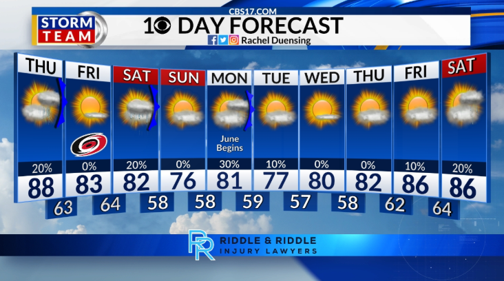
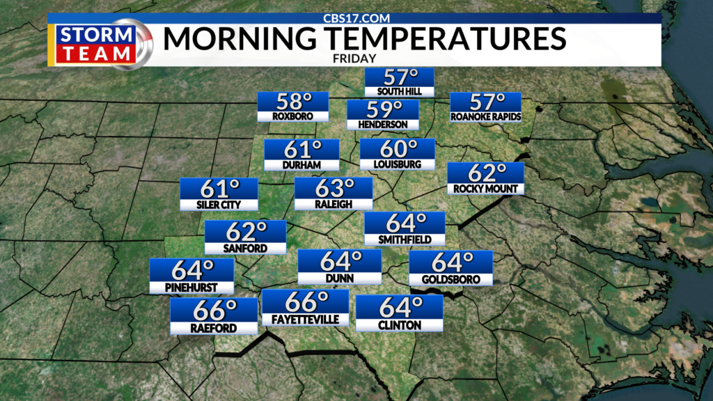
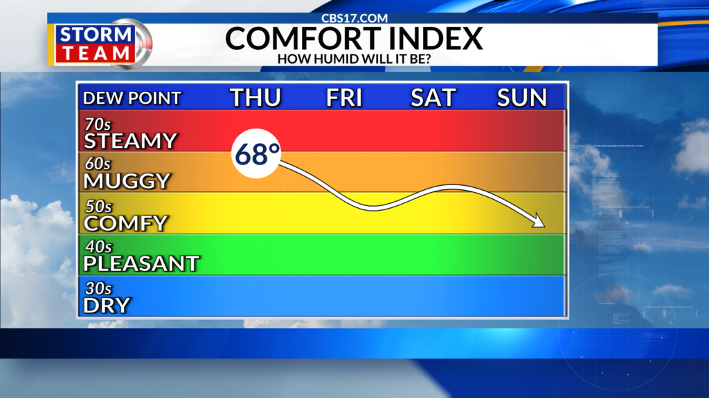
After a cloudy week with days of very warm and humid conditions, a cold front brings back more seasonal and comfortable conditions for Friday. As you wake up Friday morning, it will be noticeably cooler and less humid with lows in the low 60s compared to the low 70s the past few days. The afternoon will be what we expect for the end of May, with temperatures in the low 80s under mainly sunny skies.
Another front arrives Saturday, paired with moisture near the coast. This will keep rain chances low, and focused mainly south of the Triangle, but a few showers are possible with highs in the low 80s. Once the front slides through the area, temperatures will quickly fall into the upper 50s Sunday morning and only climb into the middle 70s by the afternoon.
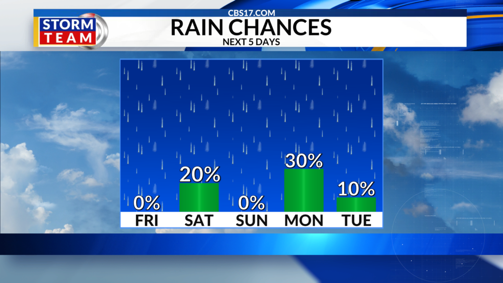
Another quick-moving front arrives Monday bringing another chance for a few showers before keeping temperatures and humidity low for most of the week ahead. Get used to mornings in the 50s and afternoons in the 70s and low 80s.
FORECAST
OVERNIGHT will be mostly clear. The low will be 63. Winds will be 5 to 10 miles per hour out of the north.
Read more Wet and warm May ahead of hurricane season start
FRIDAY will be mostly sunny. The high will be 83. Winds will be 5 miles per hour out of the northeast.
SATURDAY will be partly cloudy with a few showers. The high will be 82. Winds will be 5 to 10 miles per hour out of the northeast.
Read more NBA Finals will show if the Knicks were a great team or just benefited from good fortune