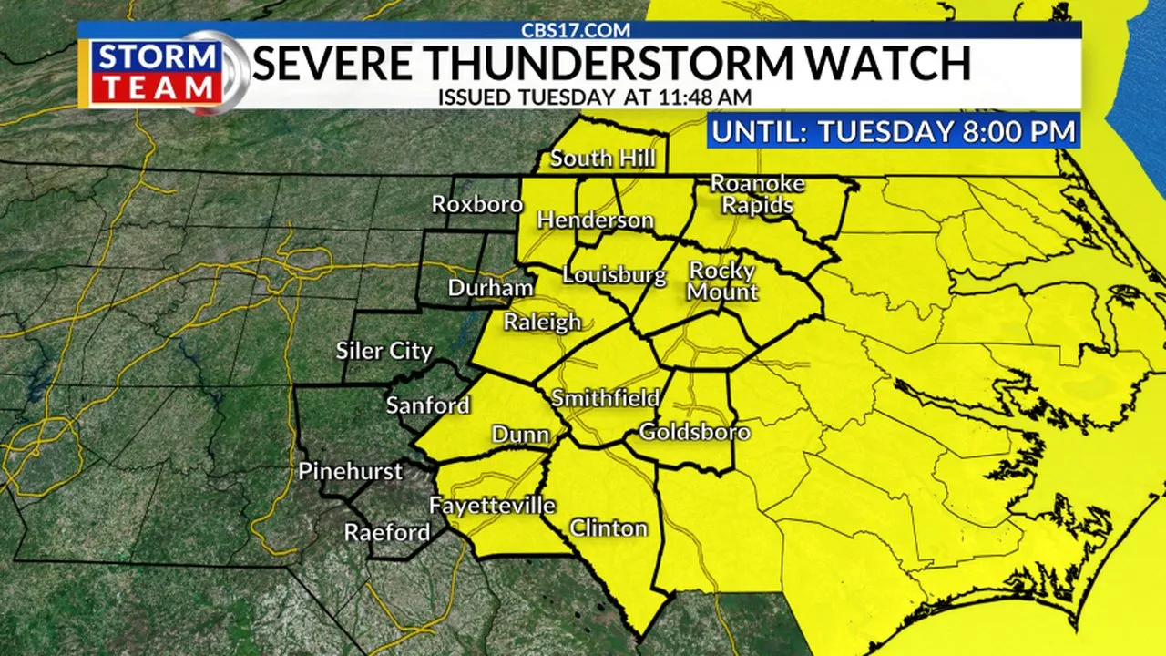
RALEIGH, N.C. (WNCN) — A large portion of central and eastern North Carolina is under a severe thunderstorm watch through Tuesday evening as forecasters warn of damaging winds and the potential for isolated tornadoes.
Read more Oilers hire Mike Babcock as coach after the NHL clears him following an investigation
The National Weather Service issued the watch at 11:45 a.m., and it will remain in effect until 8 p.m.
The following counties are included in the watch:
- Cumberland
- Edgecombe
- Franklin
- Granville
- Halifax
- Harnett
- Johnston
- Nash
- Northampton
- Sampson
- Vance
- Wake
- Warren
- Wayne
- Wilson

According to the National Weather Service, scattered to numerous thunderstorms are expected to develop across the region on Tuesday afternoon and continue into the early evening ahead of an approaching cold front.
Forecasters said the strongest storms could produce damaging wind gusts, while an isolated tornado or two cannot be ruled out. The storms are expected to move offshore later Tuesday evening.
Read more Bucks must figure out how to move forward after trading away franchise icon Giannis Antetokounmpo
The watch area stretches across parts of eastern North Carolina and southeastern Virginia, extending from near Rocky Mount eastward toward the Atlantic coast.
Residents in the affected counties are encouraged to stay alert for changing weather conditions and monitor forecasts throughout the day. Additional warnings may be issued if severe thunderstorms develop.
The National Weather Service notes that severe thunderstorms can occasionally produce tornadoes, making it important to have multiple ways to receive weather alerts.
Read more Wyndham Clark showed his toughness as the US Open champion Long Island didn’t want