RALEIGH, N.C. (WNCN) — The heat we experienced Saturday is just the beginning of what’s to come. Sunday will begin in the lower 60s before sunshine and southwest winds warm us all the way into the lower 90s by the afternoon.
The record high for the day in Raleigh is 92 degrees, set back in 1947. We’re forecasting 91 degrees. So we’ll come very close to the record.
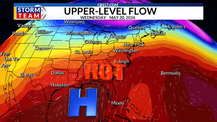
Lower 90s stick around through Wednesday before a cold front Thursday into Friday brings changes.
Rain chances finally return with the slow-moving front. Highs will drop from the 90s to the middle 80s on Thursday with middle 70s on Friday. As much as 0.50 inches of rain could fall across the area, with heavier amounts above 1 inch closer to the coast.
We’ll dry out and return to the lower 80s into Memorial Day weekend. Scattered showers look to return on Memorial Day Monday. But it’ll remain closer to average with temperatures in the lower 80s.
Read more Cardinals manager Marmol offers to buy tickets for fans to recreate shirtless revelry

FORECAST
OVERNIGHT will be partly cloudy. The low will be 63. Winds will be 5 miles per hour out of the south.
SUNDAY will be mostly clear. The high will be 91. Winds will be 5 miles per hour out of the southwest.
MONDAY will be mostly sunny. The high will be 92. Winds will be 5 to 10 miles per hour out of the southwest.
Read more Victim airlifted after Wayne County shooting Saturday on Nancy Drive, officials say