 By admin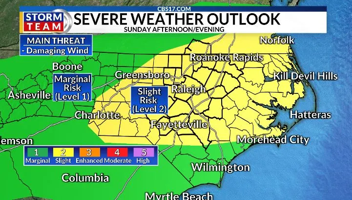
Active weather returns with a stationary front on Sunday. The front will stall across North Carolina with the heating of the day; we will see numerous storms pop up in the afternoon.
Read more Fayetteville non-profit set to build tiny home village for homeless vets
Storms can turn strong to severe across the area, with the main risk coming from strong wind gusts. Heavy rain is possible from storms, as a boundary will be very slow to move storms can run over the same areas.
In places that see more than one or slow-moving storms, flash flooding will be possible. Thanks to clouds and storms around in the afternoon, high temperatures will be knocked down to a humid low 90s.

A tropical wave moving across the Gulf has a 40 percent chance of tropical development over the next seven days. While this system is not expected to directly impact central North Carolina, it will help funnel deeper tropical moisture into the region.
That added moisture will continue interacting with the stalled boundary on Monday, leading to another round of scattered afternoon and evening thunderstorms. The strongest storms will once again be capable of producing damaging wind gusts, torrential rainfall, and frequent lightning.

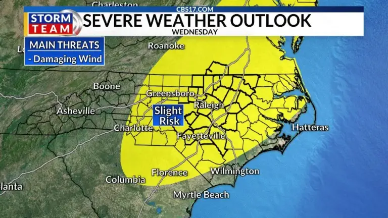
Tuesday should offer a brief break in the active weather, with fewer showers and thunderstorms expected. However, that lull won’t last long. A stronger cold front is forecast to sweep through on Wednesday, bringing another widespread round of showers and thunderstorms.
Read more What’s Trending on CBS17.com
The Storm Prediction Center is already highlighting central North Carolina for the potential of strong to severe storms, with damaging straight-line winds expected to be the primary threat.

With multiple rounds of rain and storms expected through the middle of next week, it’s important to stay weather-aware and monitor the latest forecasts from the CBS 17 Storm Team. Once Wednesday’s front clears the area, noticeably less humid air will move in, bringing a refreshing stretch of drier weather and cooler temperatures to end the week.

Follow the CBS 17 Storm Team on socials for the latest weather updates:
Chief Meteorologist Wes Hohenstein: Facebook | X | Instagram
Morning Meteorologist Rachel Duensing: Facebook | X | Instagram
Meteorologist Ross Whitley: Facebook | X | Instagram
Meteorologist Matthew Huddleston: Facebook | X | Instagram
This forecast was prepared by the CBS 17 Storm Team and is based on the latest information available and years of weather forecasting experience in North Carolina. It was not produced by a computer like many forecasts you find on the web, social media and smart phone apps.
Read more Apex police seek info after teen involved in E-bike crash on Apex Peakway